
Cultural Landscape Report
During my internship at OCLP, I was tasked with finishing the Boston Harbor Islands National & State Park CLR, a project 20 years in the making. This effort required managing fieldwork on my own in a remote setting among 34 islands, taking and editing photos to be published publicly, updating outdated research and terms to contemporary standards, and maintaining existing and forging new relationships with multi-disciplinary partners, including: conservation alliances, NPS and state entities, stewardship programs, and local universities.
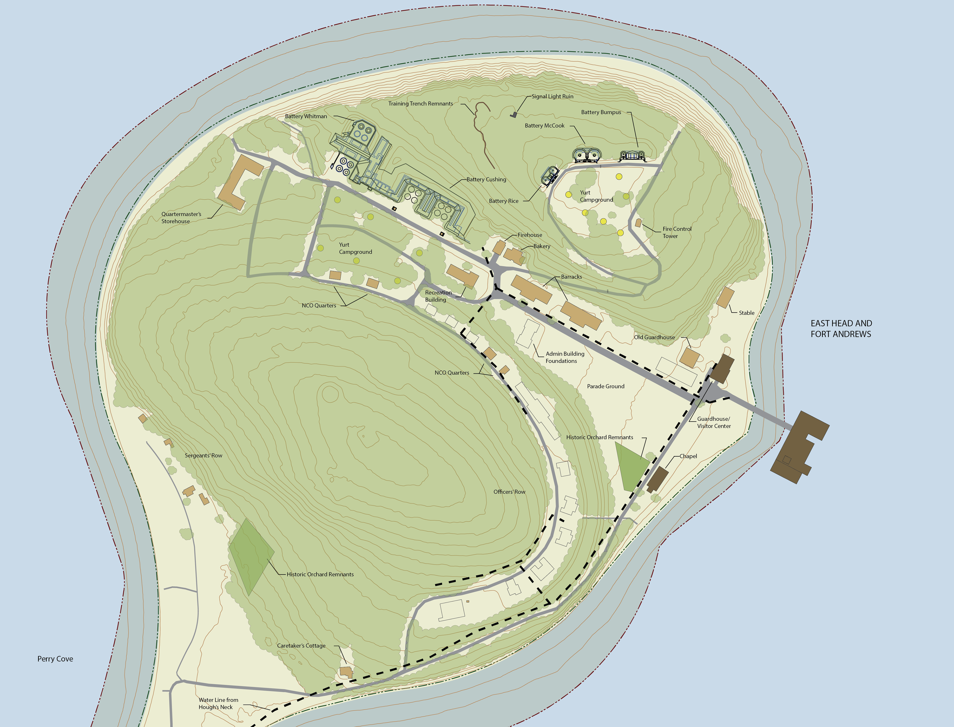
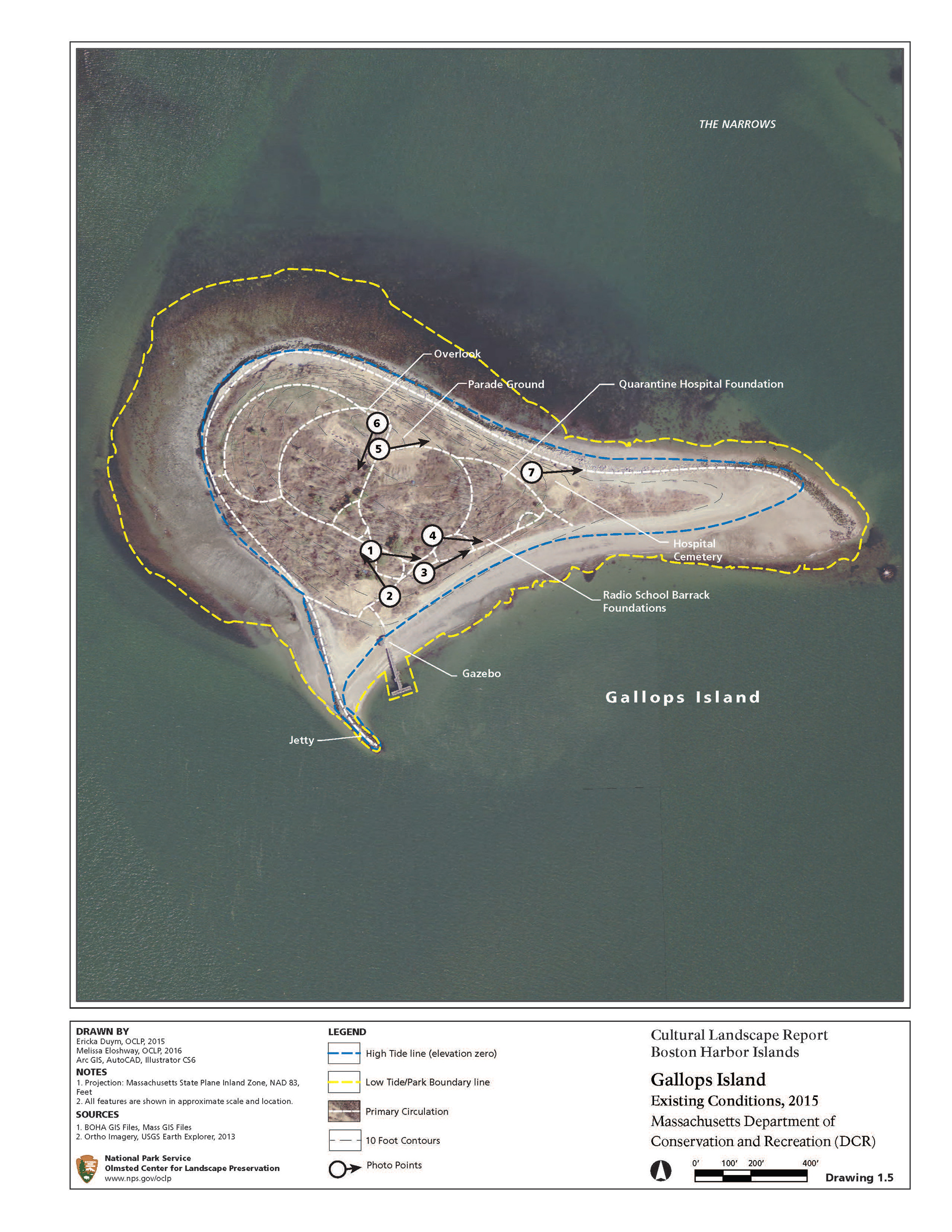
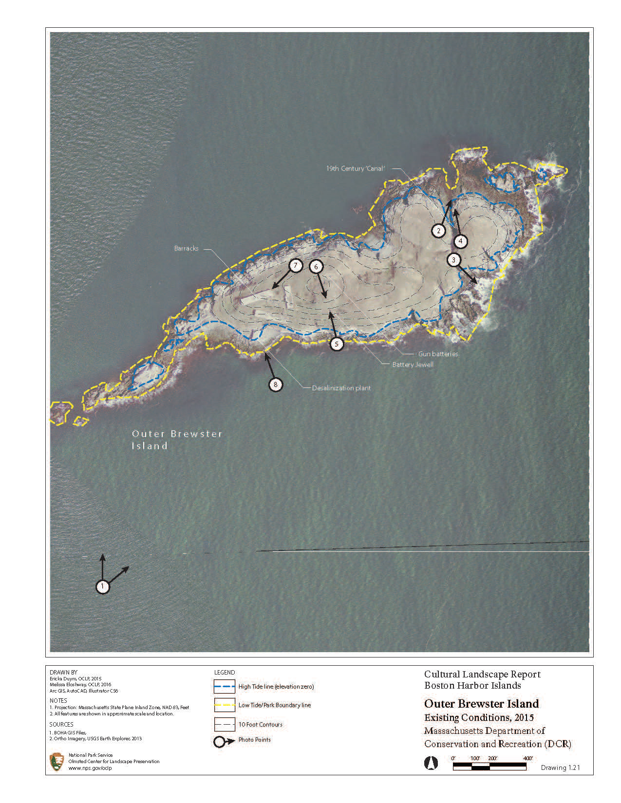
The maps below are examples of existing conditions illustrations showing park boundaries and tide lines, circulation, infrastructure, and photo view points.
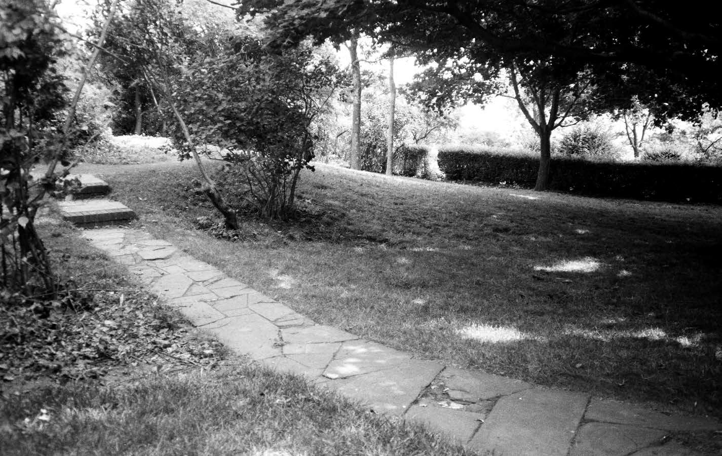
The images below are representative of matching point of view images taken in the 1990's and 2010's. These. photos document changes in the landscape according to management strategies, and will inform future landscape management, design, and planning,
Gallops Island 1999
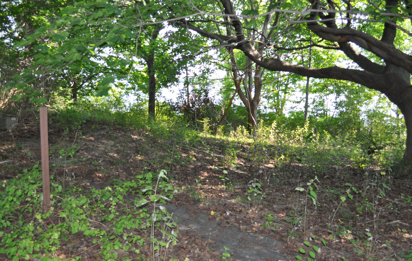
Gallops Island 2016

Outer Brewster 1999
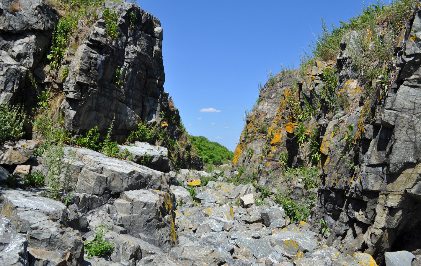
Outer Brewster 2016
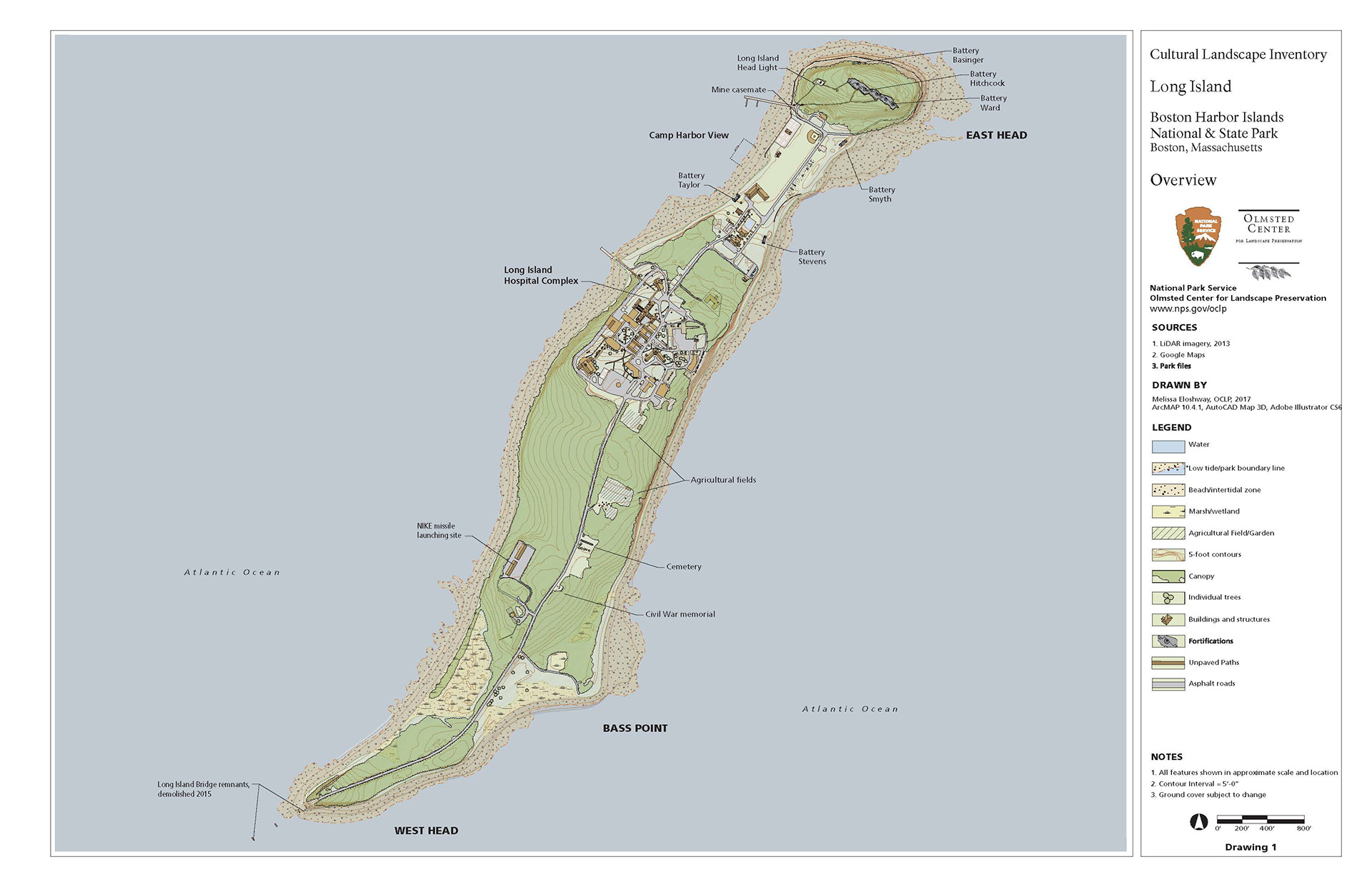
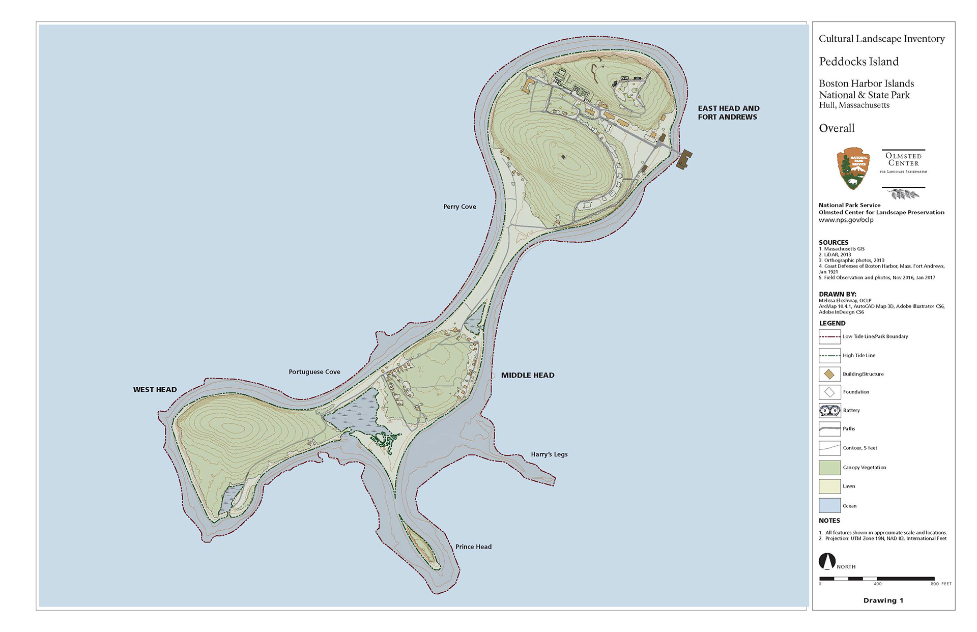
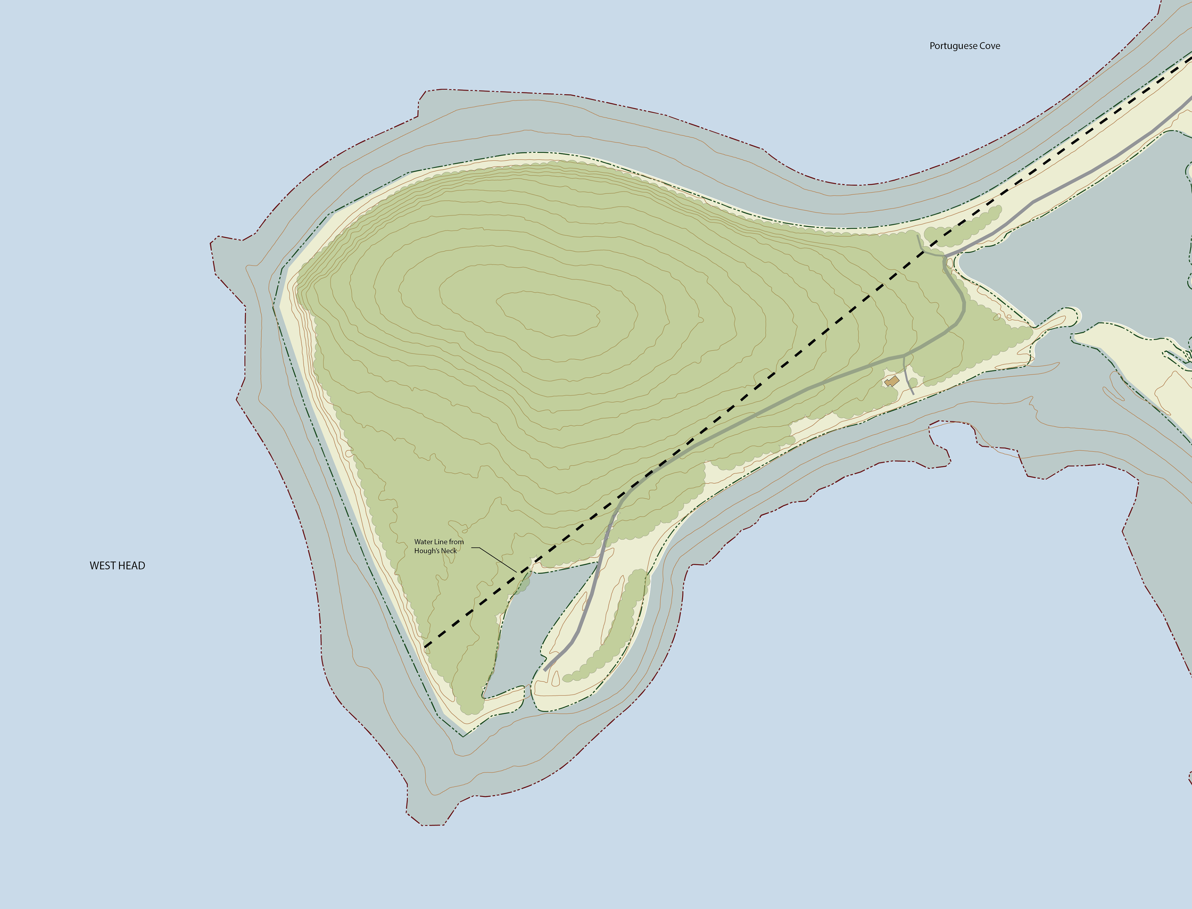
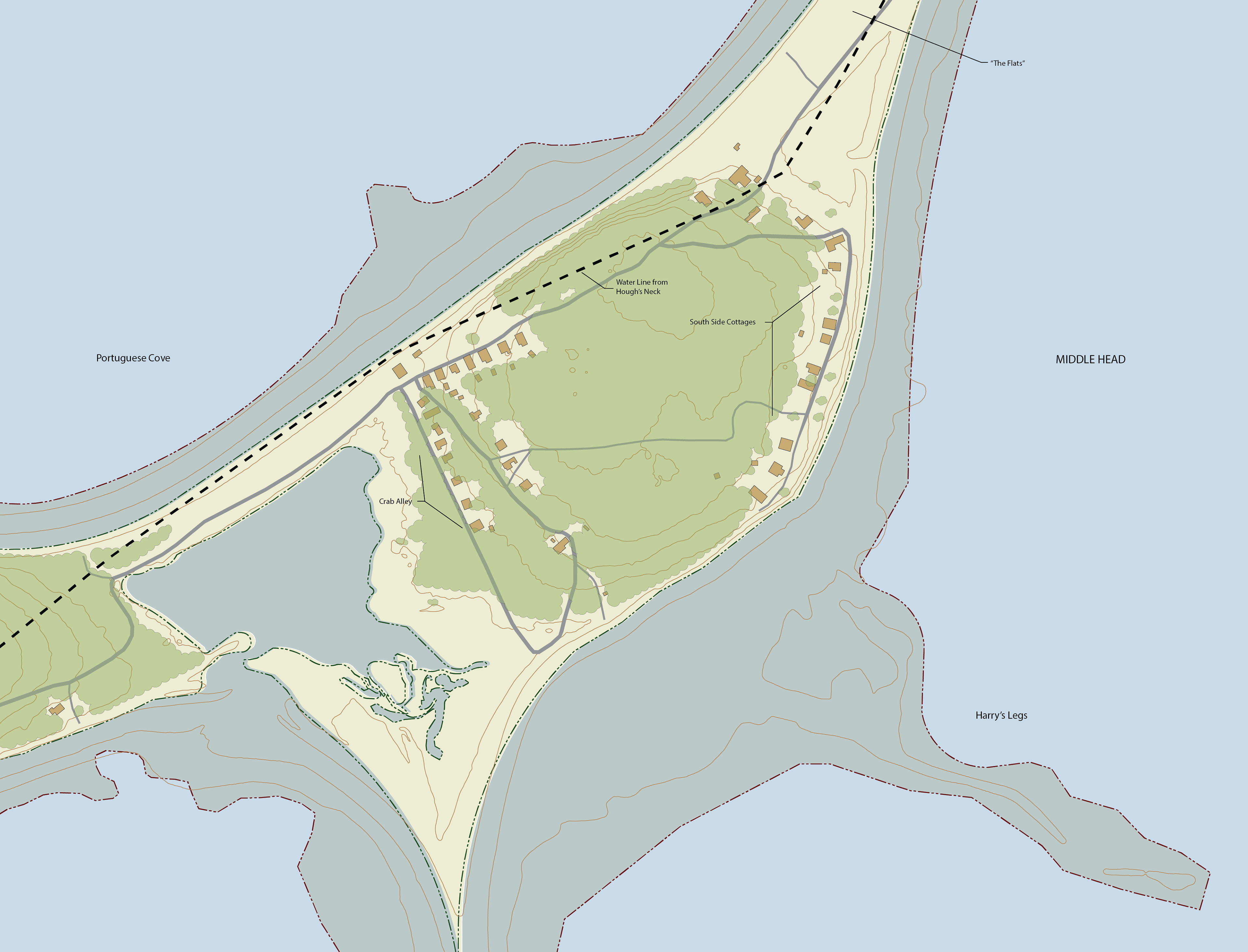
Cultural Landscape Inventory
As an intern at the Olmsted Center, my main project was to produce an initial draft of the Peddocks Island CLI and the Long Island CLI. These CLIs were produced in anticipation of future recreational planning and design, and would inform stakeholders of critical historic infrastructure extant in the landscape. These efforts included fieldwork, mapping existing conditions via fieldwork, historical photographs and narratives, GIS, and research in the areas of various occupations (First, military, and domestic). This project critically informed my skills and interests as a designer and preservationist, especially in terms of ensuring efficient fieldwork, clear communication, and paying close attention to cultural and ecological connections that may inform future narratives in place.
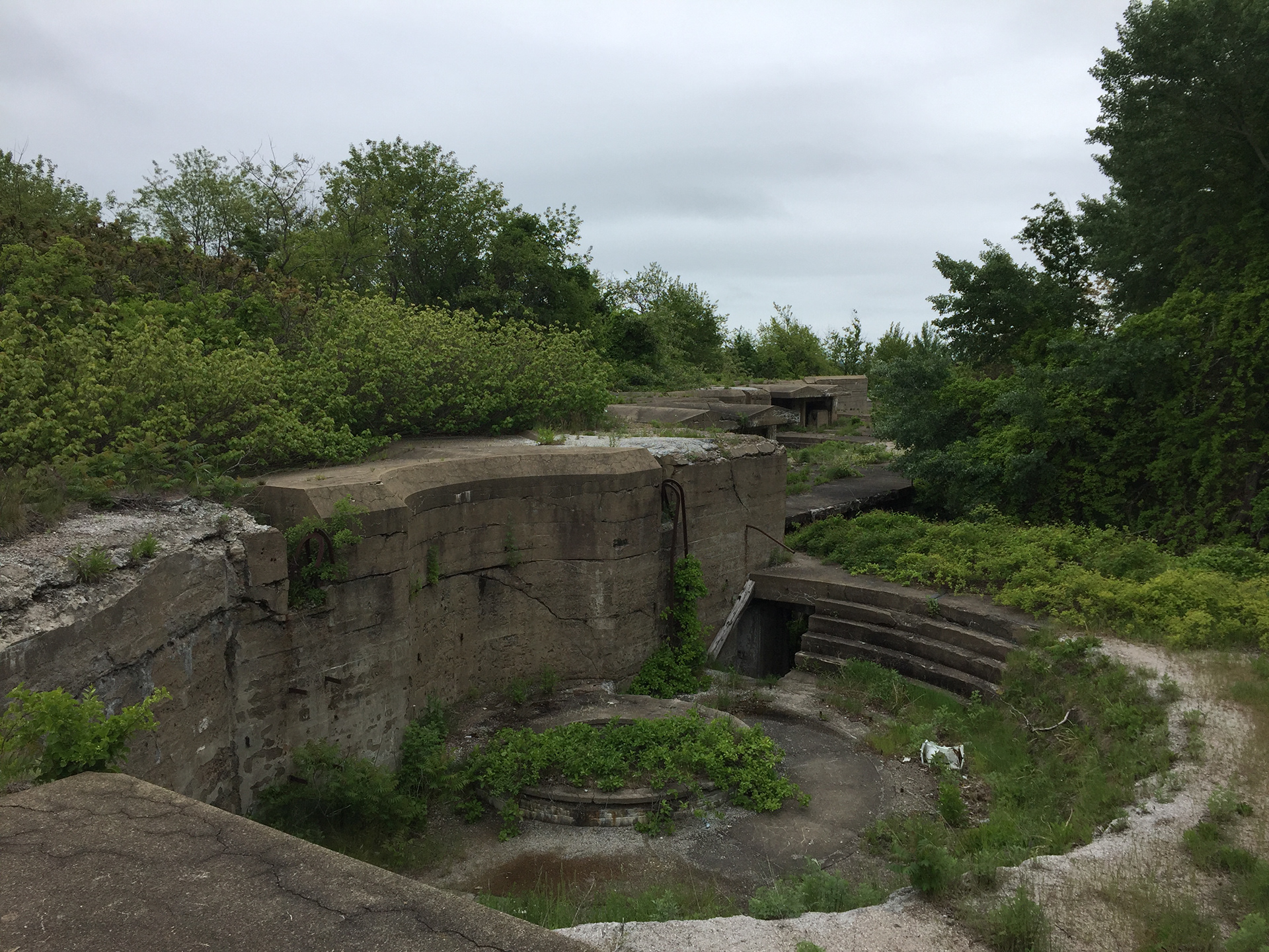
Long Island: Kennedy Battery
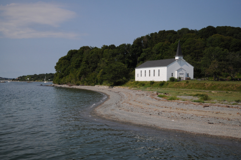
Peddocks Island: Chapel and shore on East Head
Using data from park files, MassGIS, aerial orthoimagery, and LiDAR, these maps are created and can then serve as a baseline mapping tool for identifying potential areas in need of maintenance adjustments, development, or preservation. In producing the maps for the Long Island CLI and the Peddocks Island CLI, it was important to define park boundaries clearly along with high and low tide lines, especially as those boundaries are constantly shifting with a changing climate. Locations of yurt camping sites on Peddocks Island’s East Head were informed by mapping and researching Fort Andrews.