
Germantown Ave Cut-Throughs
This research into Philadelphia, PA's Germantown Avenue was completed in a course on land abandonment and land care. The work explores the structural systems behind abandonment, uncovering potential spatial relationships between property deemed “vacant” and issues of political disinvestment and forced displacement, predatory lending practices, health and wellbeing indicators, and the environmental conditions of the immediate urban landscape.
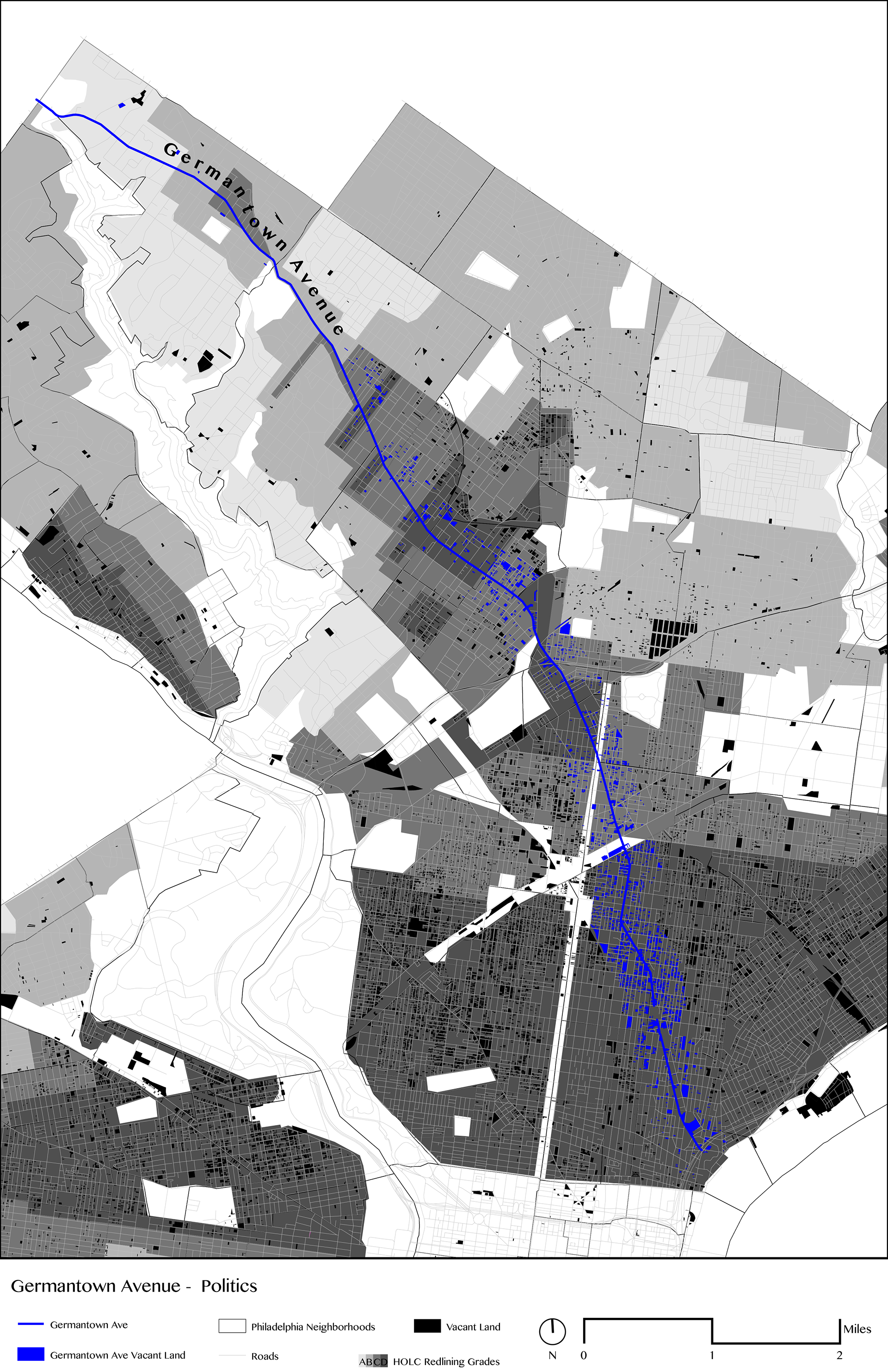
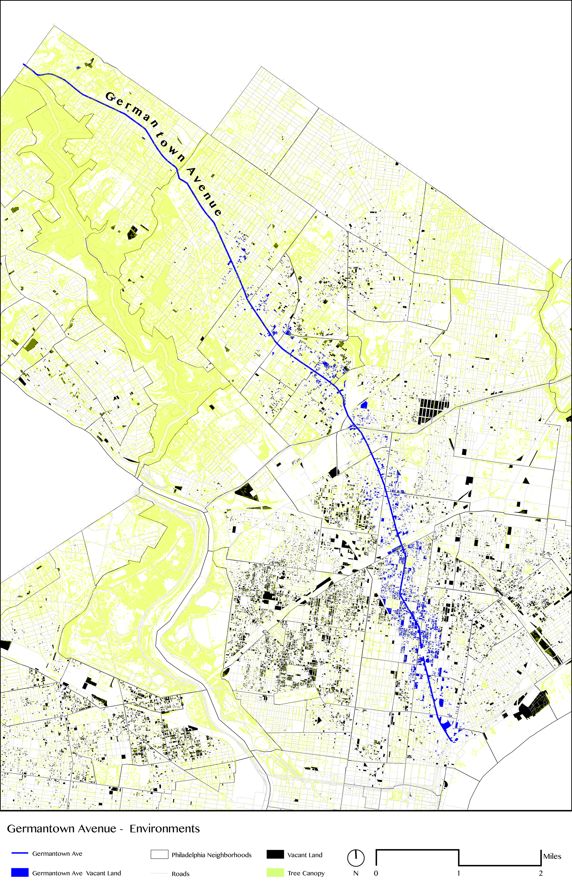
"Atlases of Abandonment" were created to form a design argument. The atlases above show Germantown Avenue as a historic artery from inner Philadelphia to its suburbs, which also represents a gradient of land value and abandonment. Overlaid with HOLC redlining practices, connections can be seen between a low HOLC grade and land that is currently vacant. Additionally, an environmental atlas shows a similar gradient of street trees, emphasizing a disparity in redlined neighborhoods and disinvestment in property.
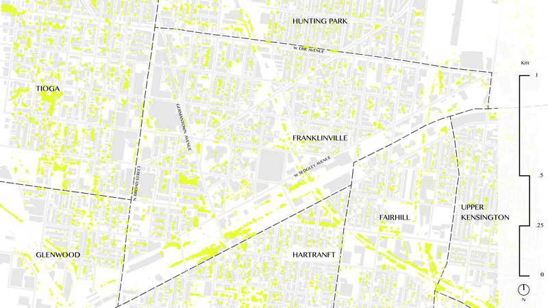
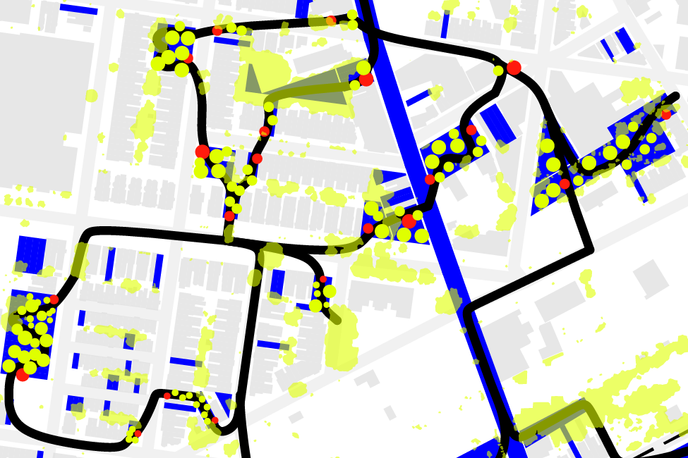
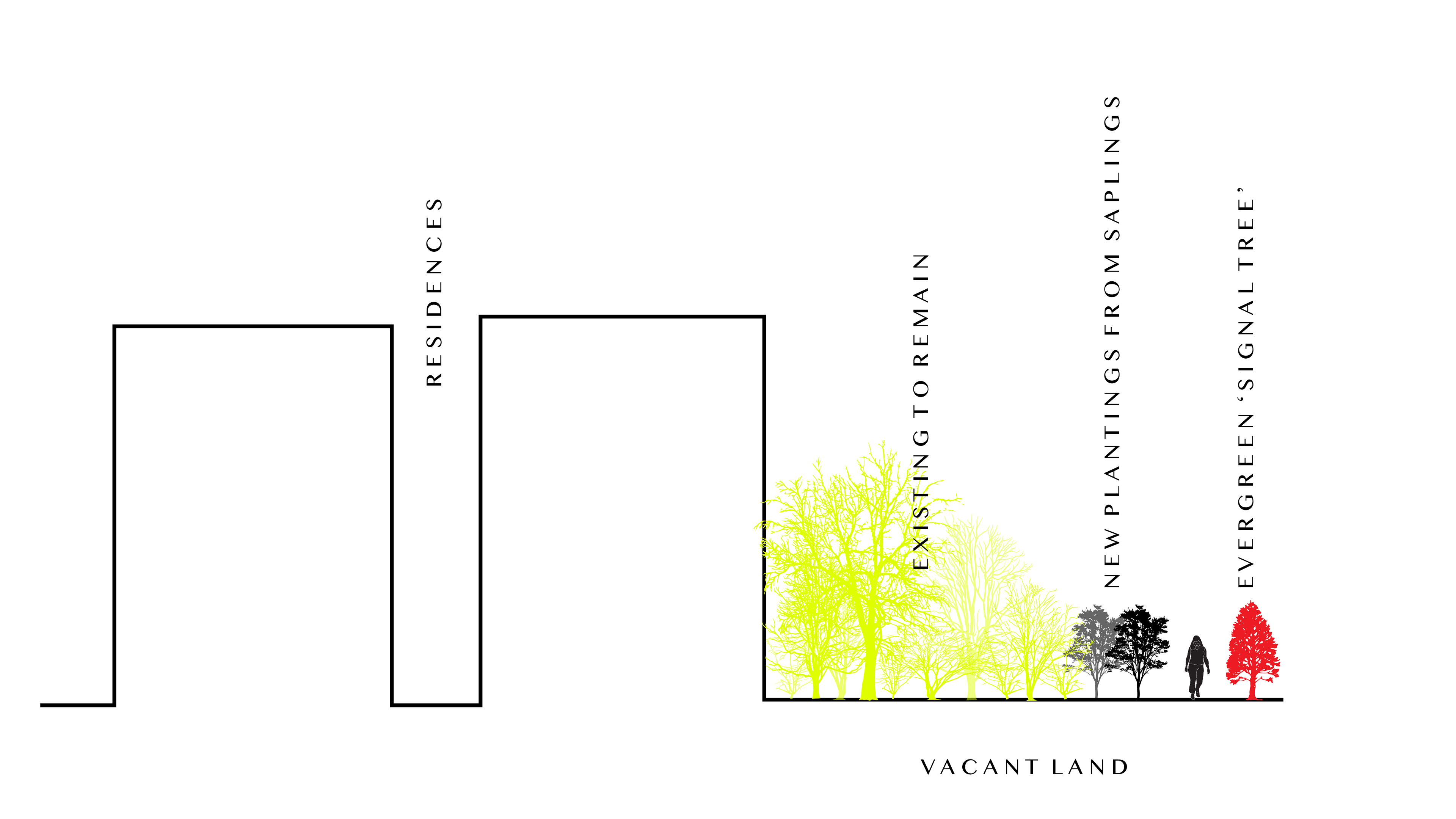
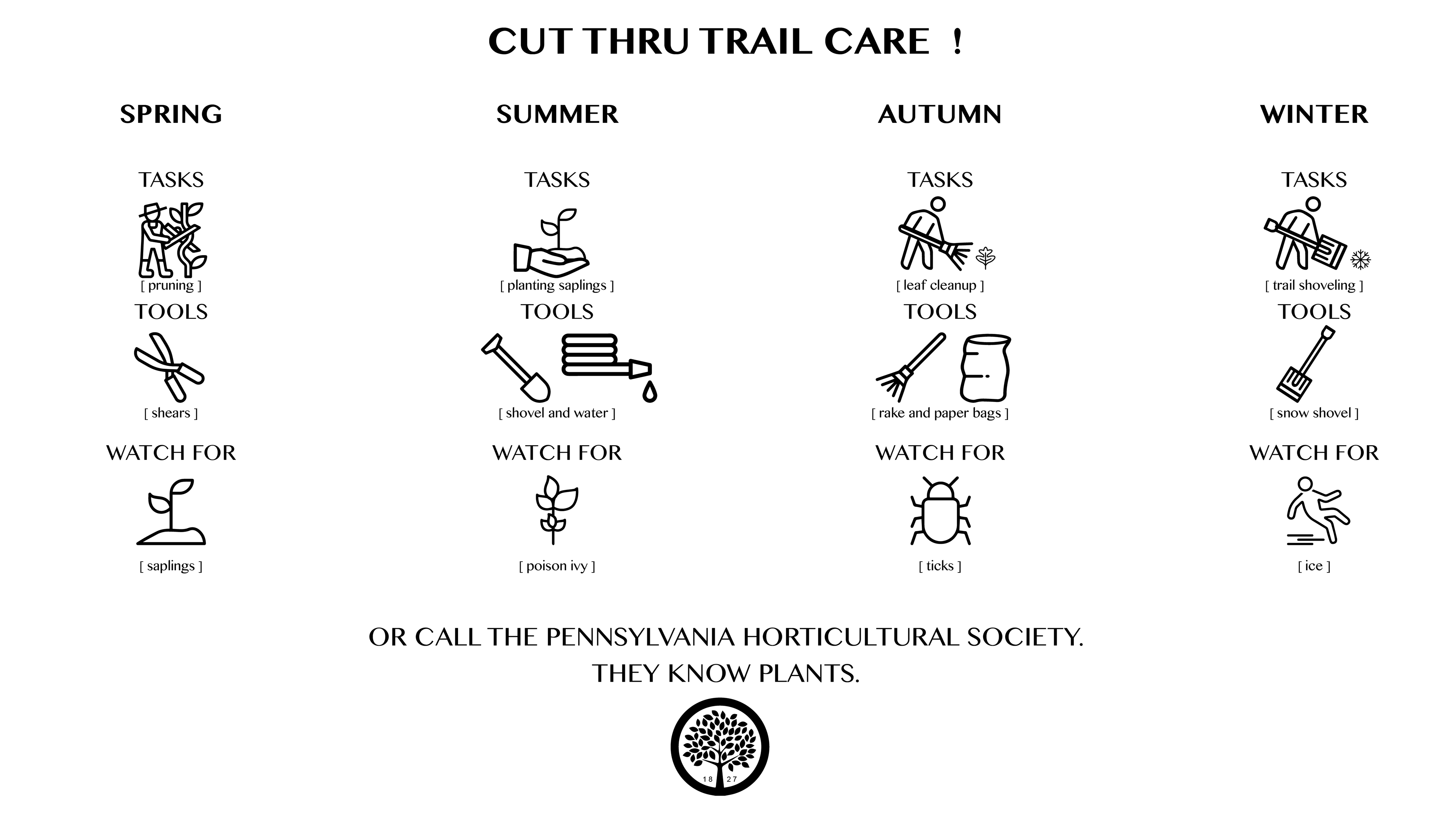
Based on the atlases, a design and care strategy was conceived. Highlighting vacant land within a .5 mile radius of Germantown Avenue, I designed a walking trail network of cut throughs. The goal was to introduce an aspect of increased public ownership of land currently left vacant by the simple act of taking up space by walking through. The vacant plots would be planted and cared for by the community, in partnership with the Pennsylvania Horticultural Society.
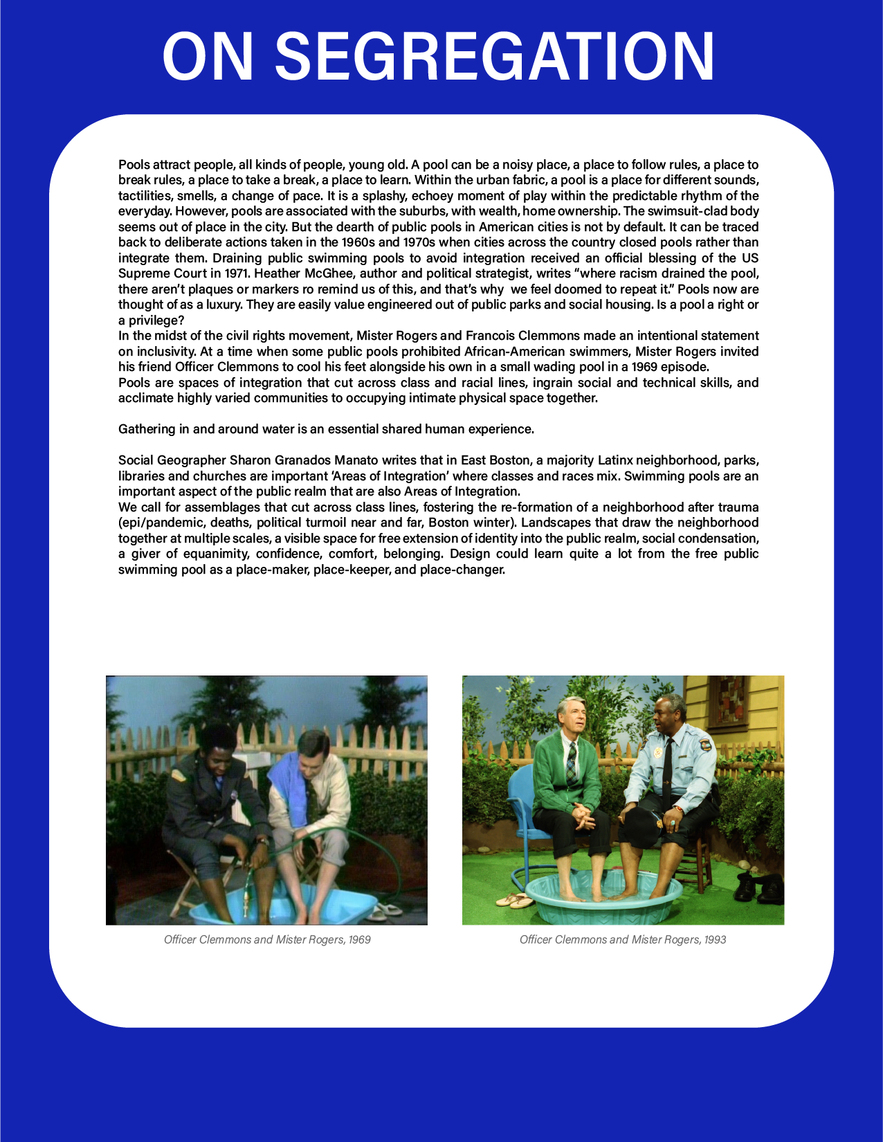
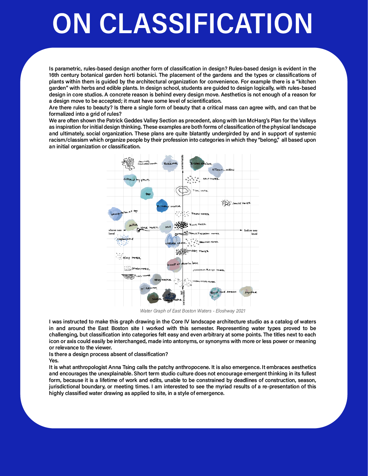
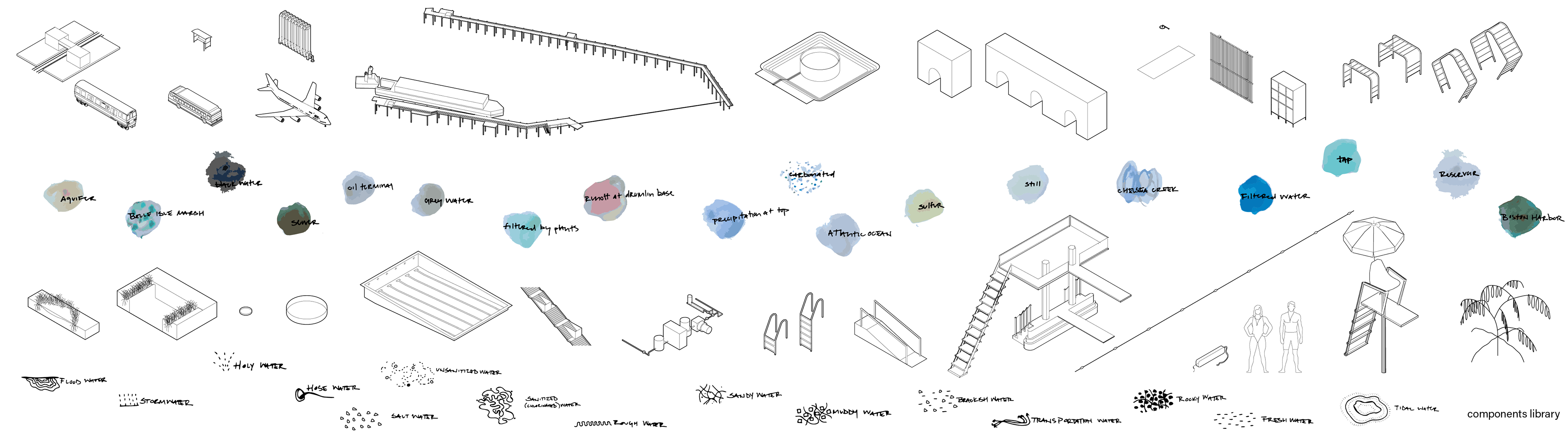
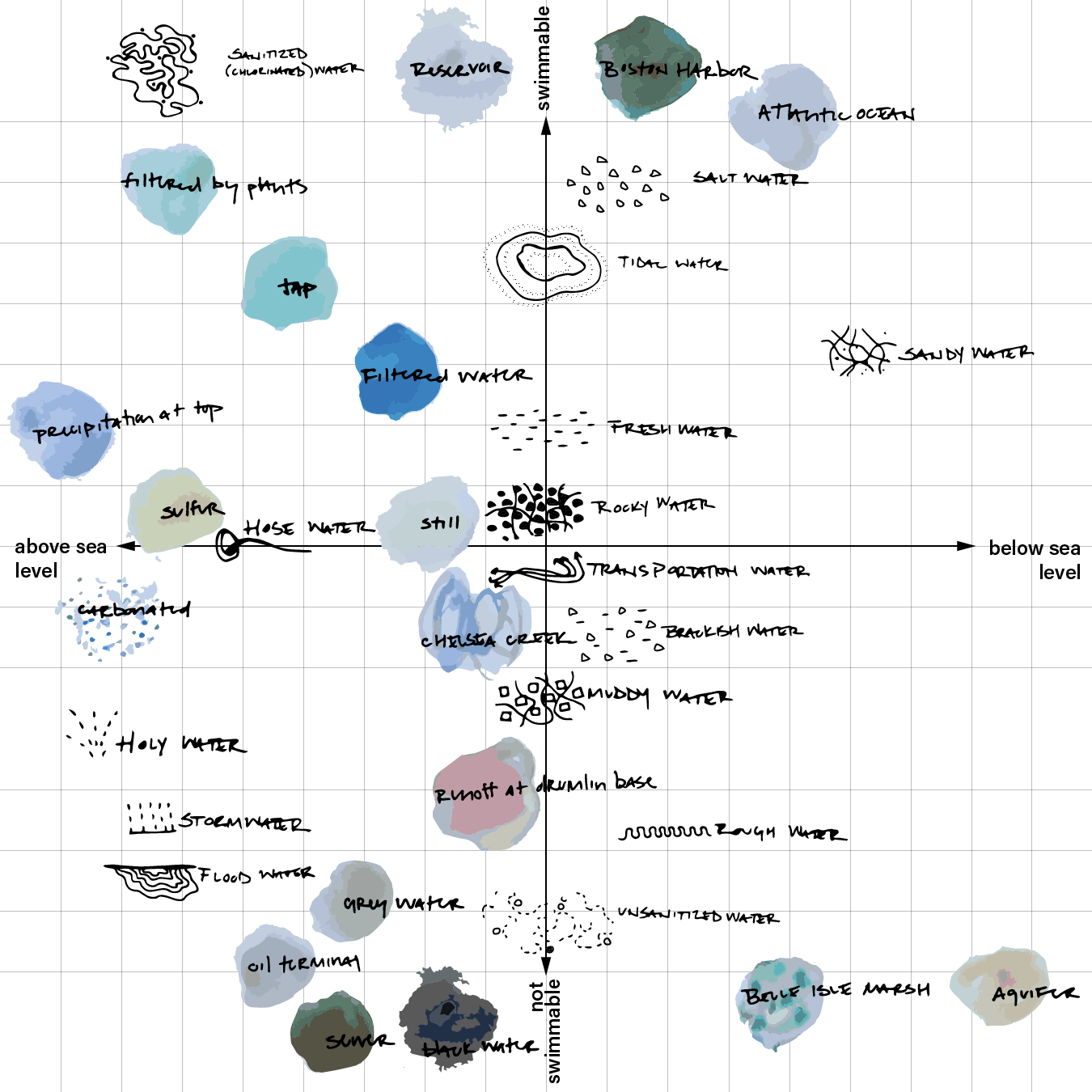
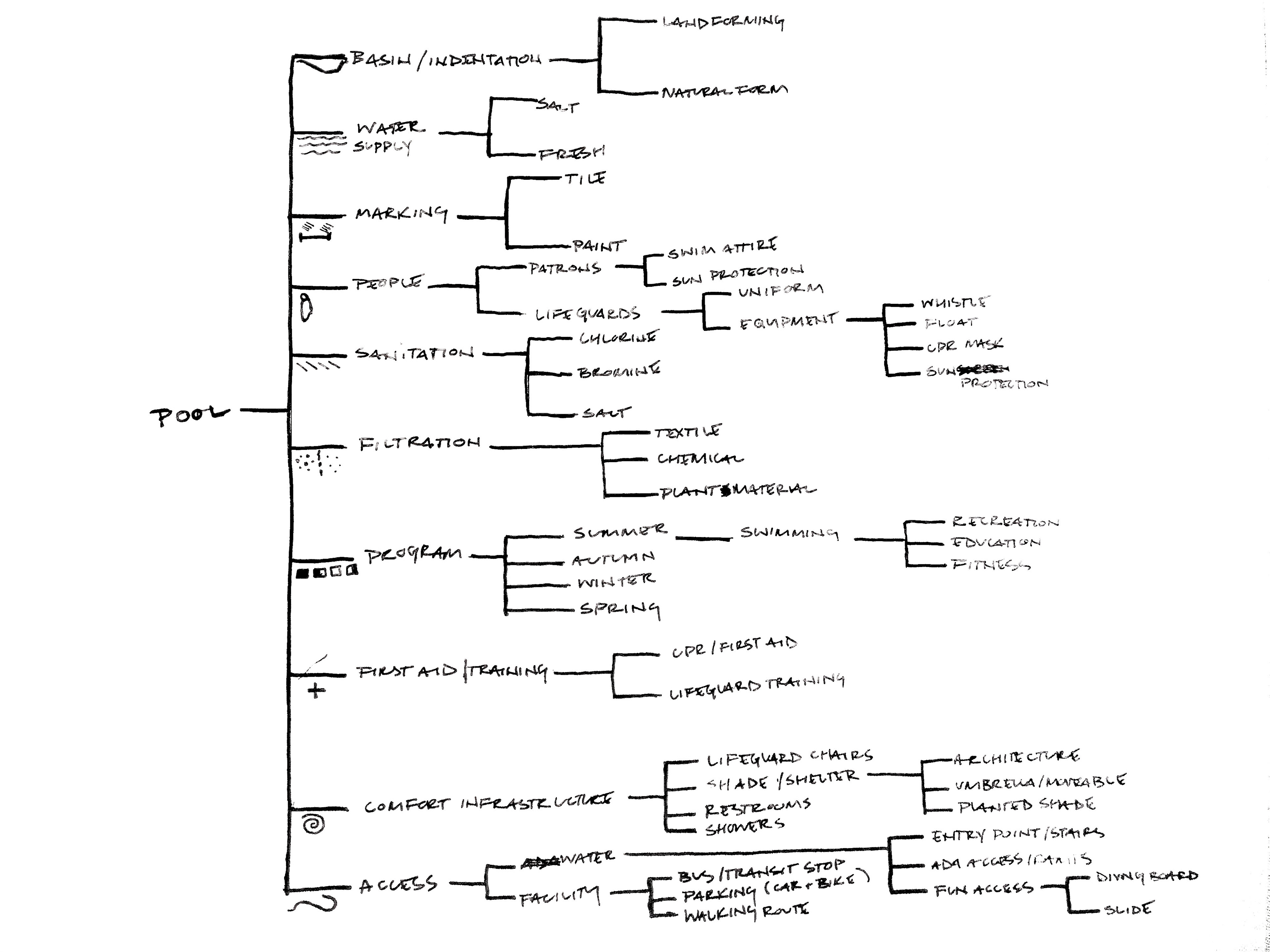
Manifesto on the Free Public Swimming Pool
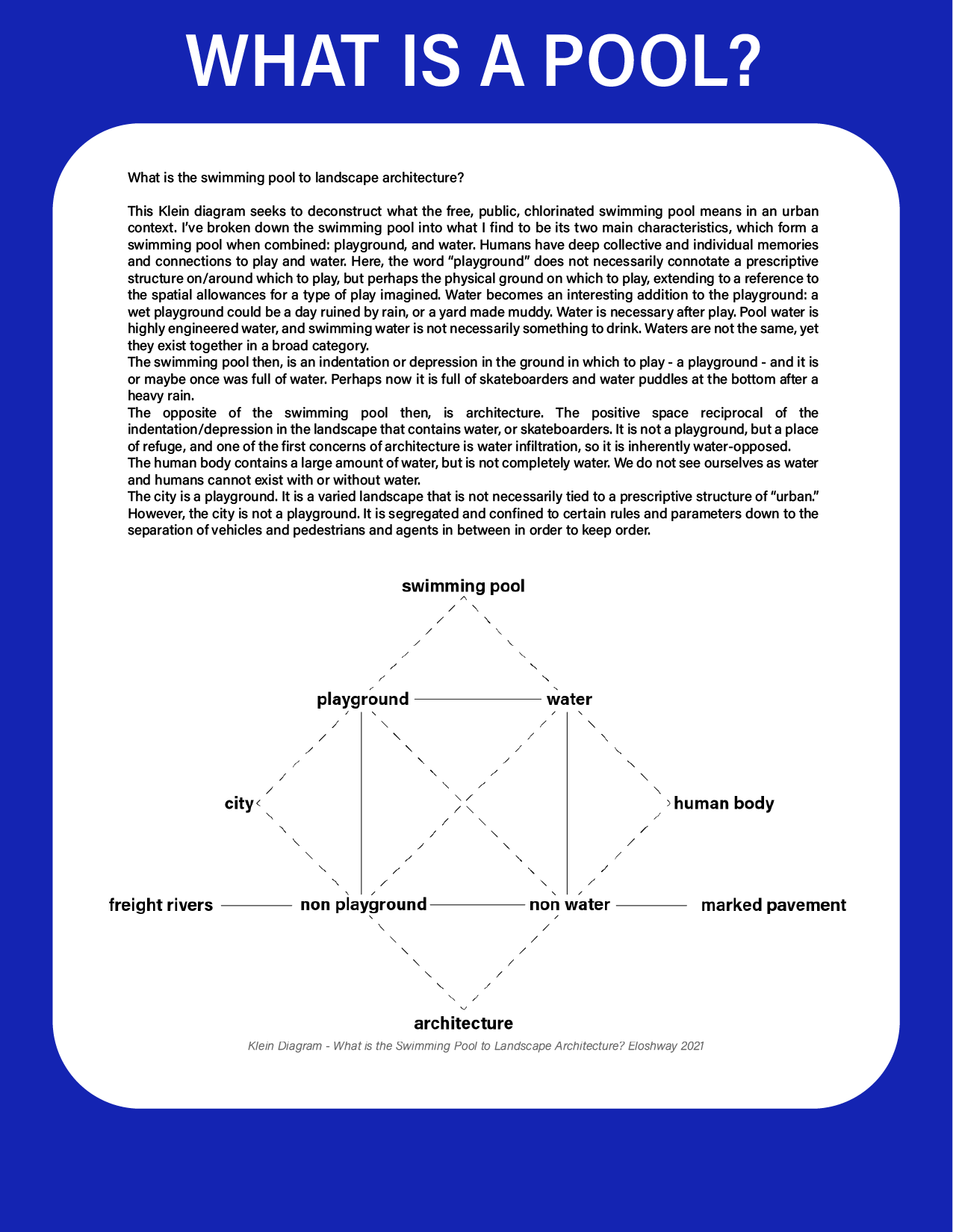
This research supports the studio project The Disordered Backyard: A non-park landscape of juxtaposition, and explores the relationship between the free public swimming pool and the city. The relationship is explored through informal manifesto, Klein diagram, pop culture, social landscape, classification, and cataloging.

Petrochemical (corri)door: The inside/outside problem
This research explores the siting of Agriculture Street Landfill in the Desire Neighborhood of New Orleans, Louisiana in relation to the history of the siting of infrastructure "outside" of the urbanized area, without planning for future development. The landscape has incurred a slew of damages with short term effects like damage to homes and infrastructure due to extreme weather, and long term effects of the same storms to local ecologies, as well as effects of systemic racism through inequitable siting of infrastructure such as landfills, and the development/use of the same land while withholding context that is integral for upholding public health standards.
The Agriculture Street landfill is not recognized on survey maps, pulling into question the lens through which cartographers depicted the city, and contributing to a narrative of concealing information on the safety of living on superfund sites.
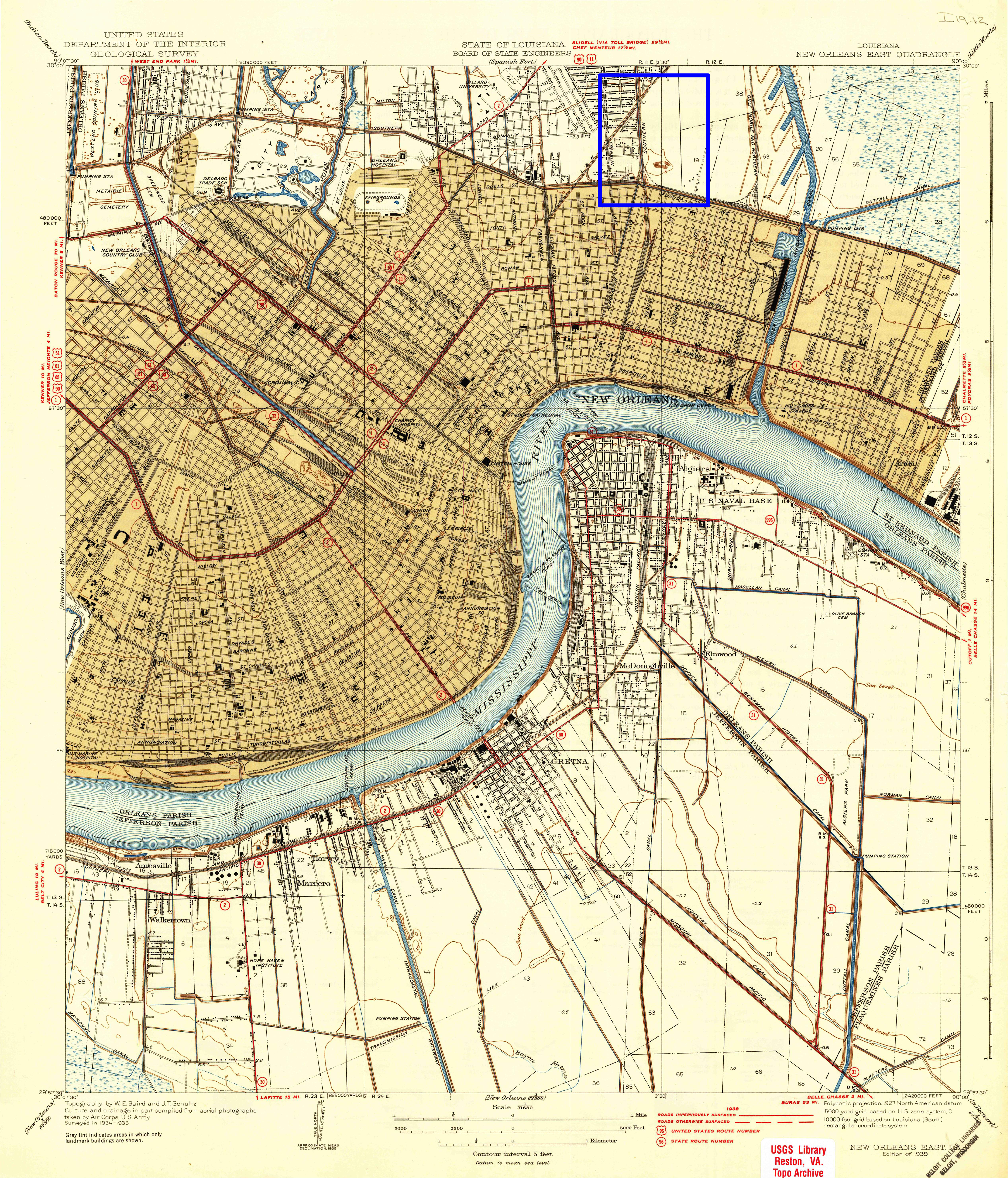
U.S. Geological Survey, 1939, USGS 1:31680-scale Quadrangle for New Orleans East, LA 1939, 1966,1992:https://nationalmap.gov/historical/
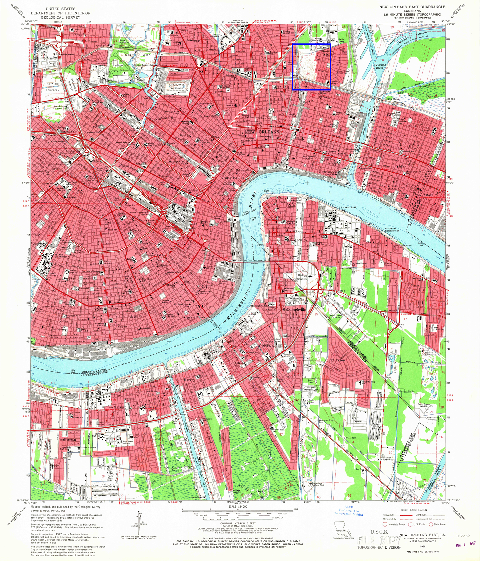
U.S. Geological Survey, 1966, USGS 1:31680-scale Quadrangle for New Orleans East, LA 1939, 1966,1992:https://nationalmap.gov/historical/
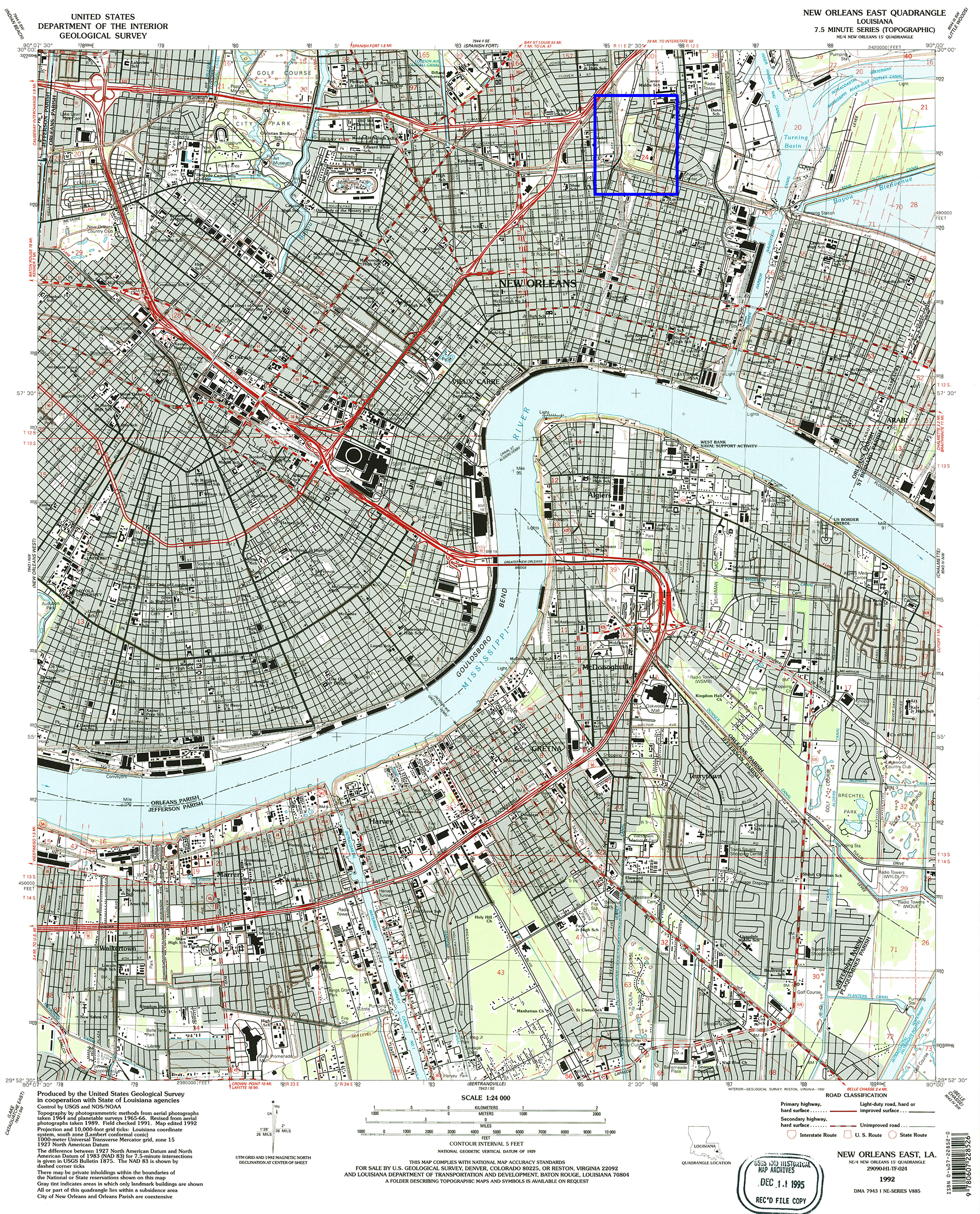
U.S. Geological Survey, 1992 USGS 1:31680-scale Quadrangle for New Orleans East, LA 1939, 1966,1992:https://nationalmap.gov/historical/

The Critical Visualization and Media Lab of Tulane University, 2019, “Smoke,” inThe American Dream Denied,https://scalar.usc.edu/works/the-american-dream-denied/the-promised-american-dream_p1b
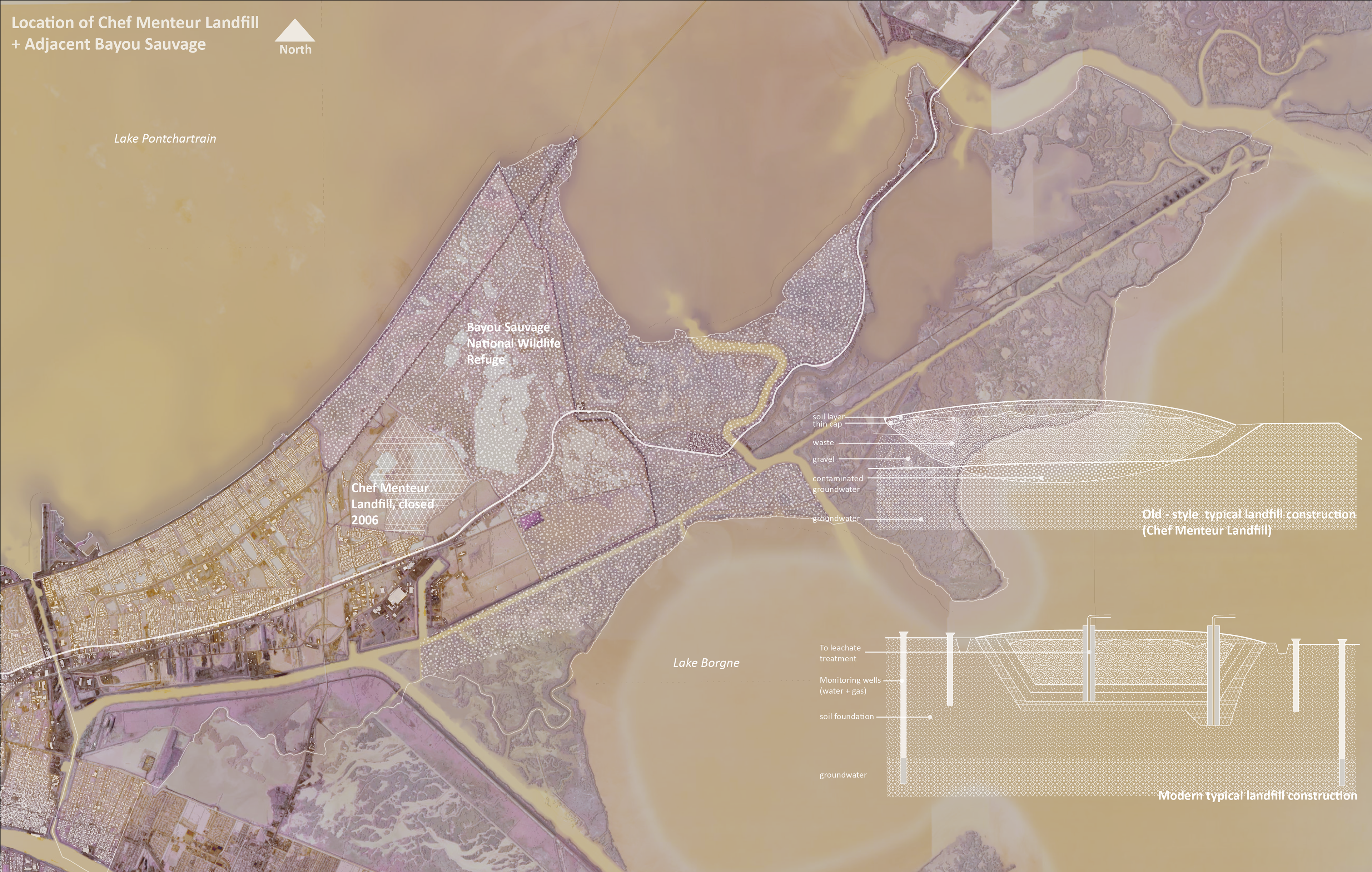
The landfill continues to cause disturbances in local ecologies 120 years later, and set a precedent for poor siting of waste disposal sites even into the 21st century. An example of this is the Chef Menteur Landfill, constructed after Hurricane Katrina to receive debris from the storm. The landfill was not properly constructed according to code, so asbestos and creosote coated housing materials in the landfill are seeping into groundwater, affecting adjacent ecologies and communities.
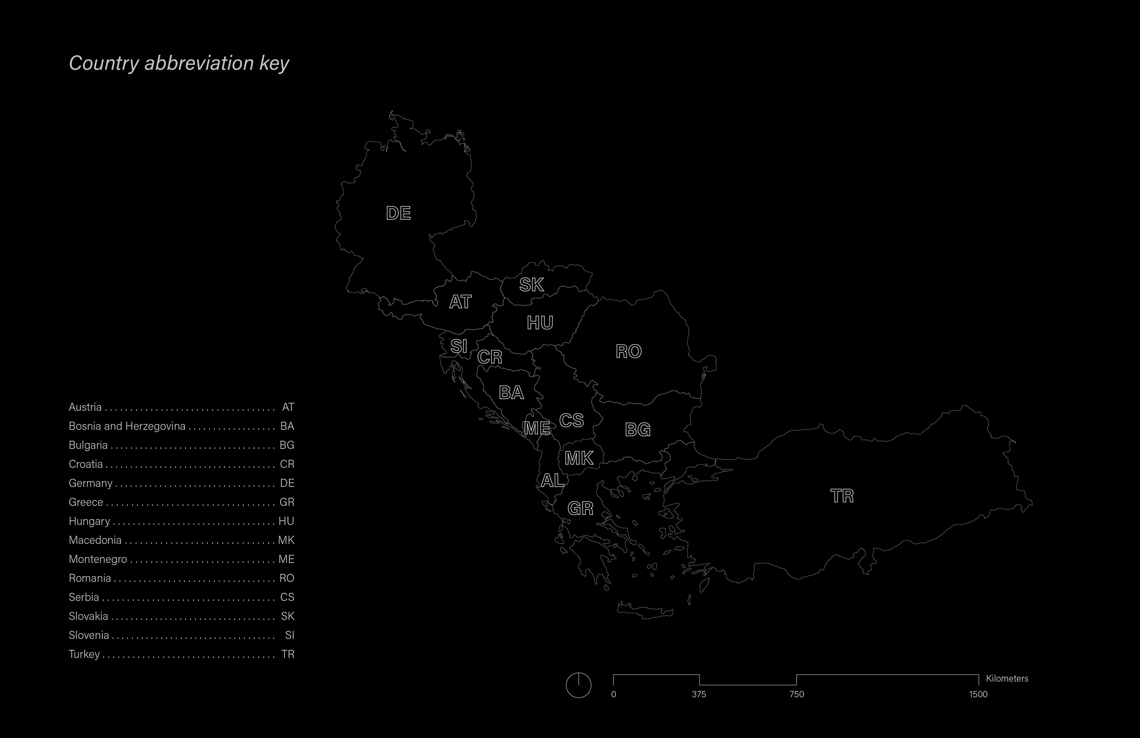
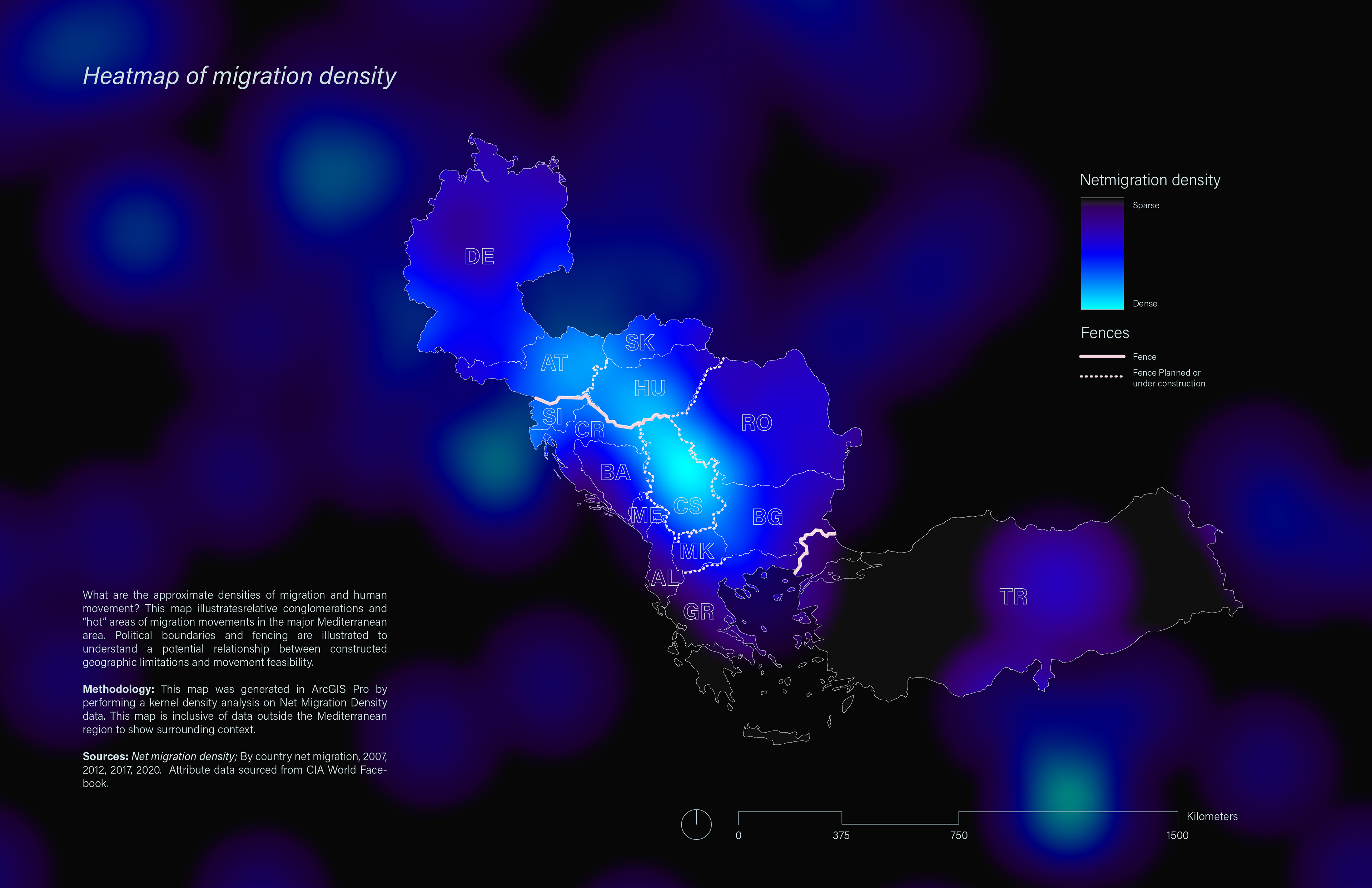
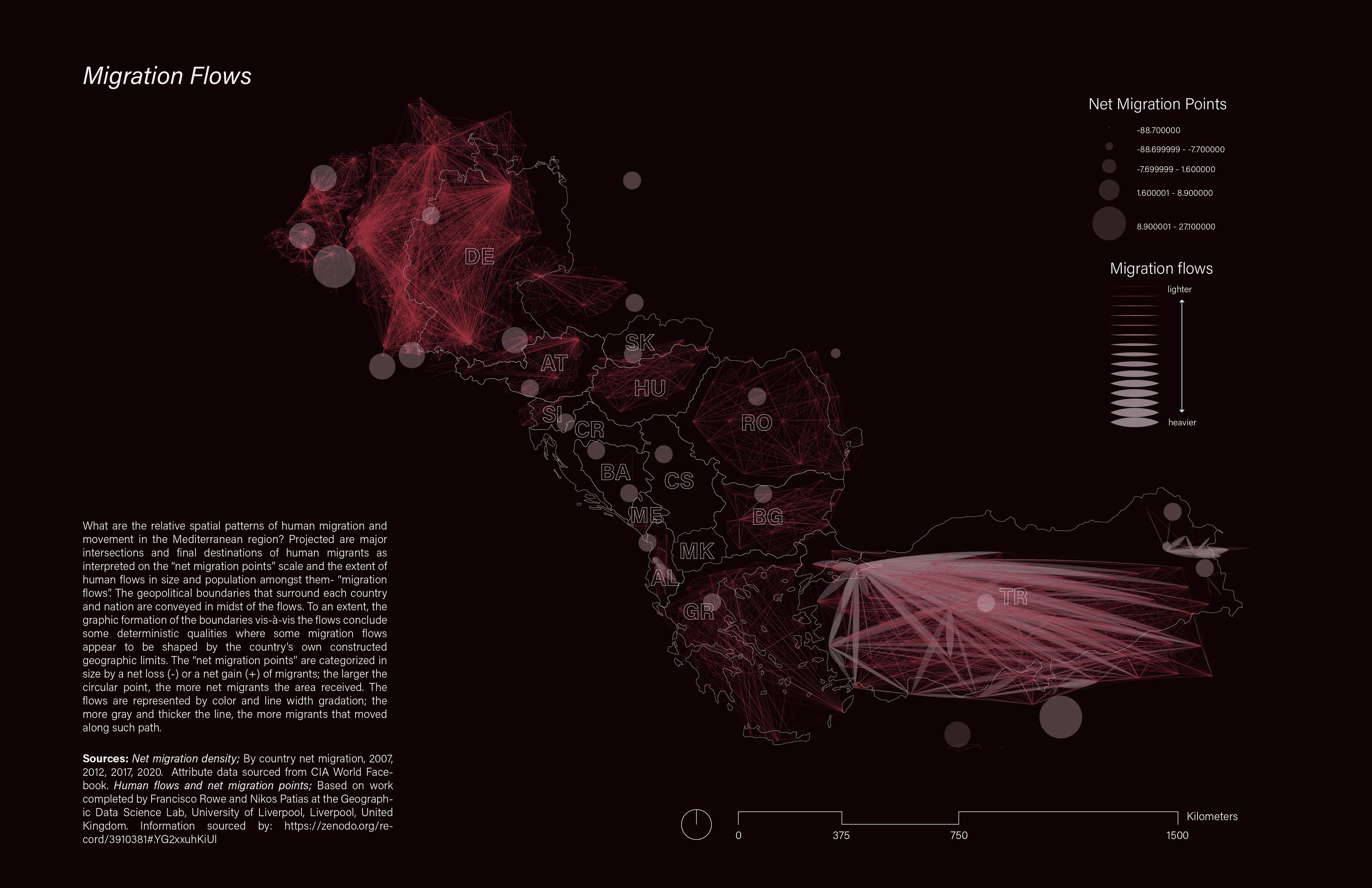
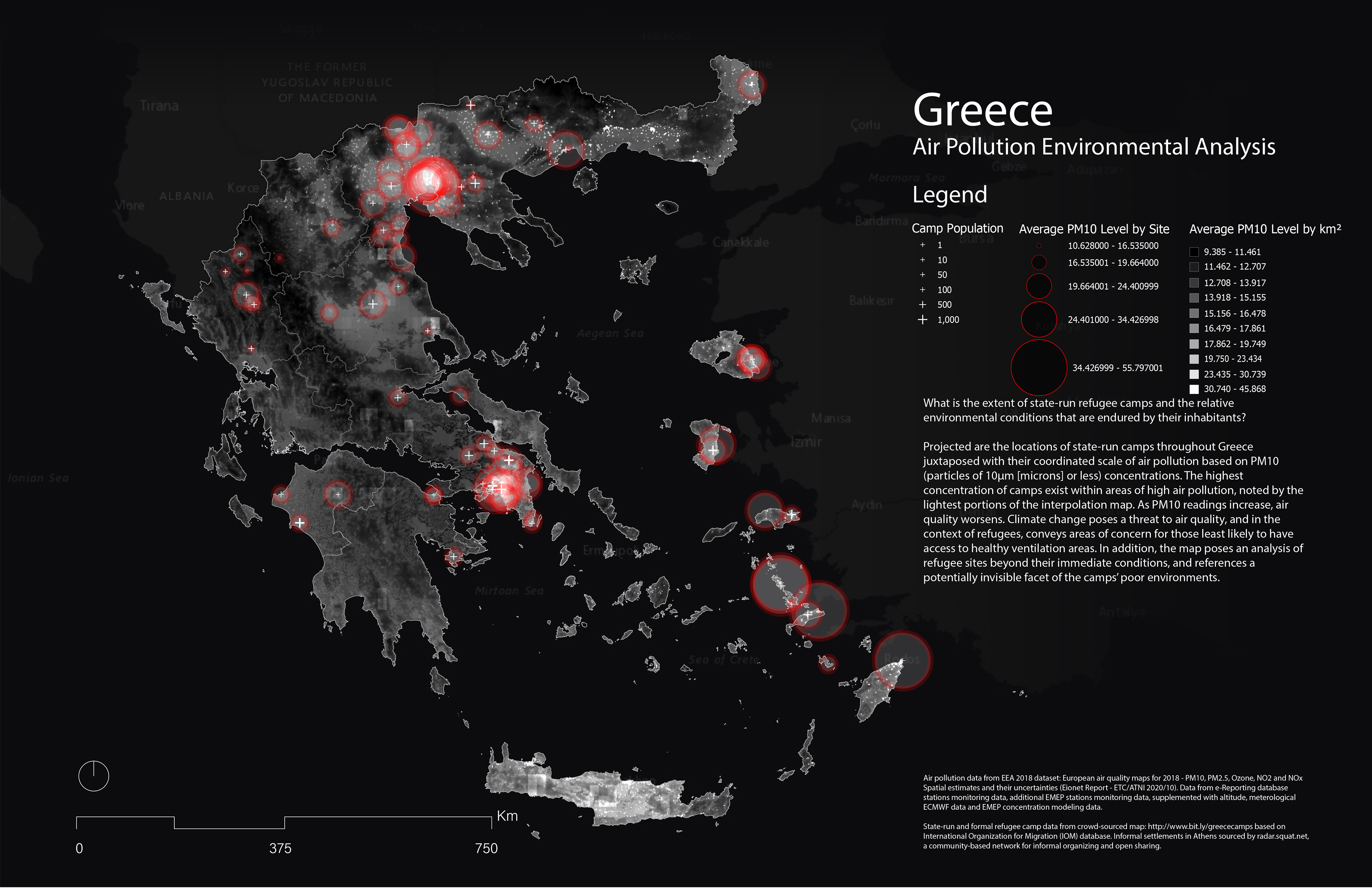
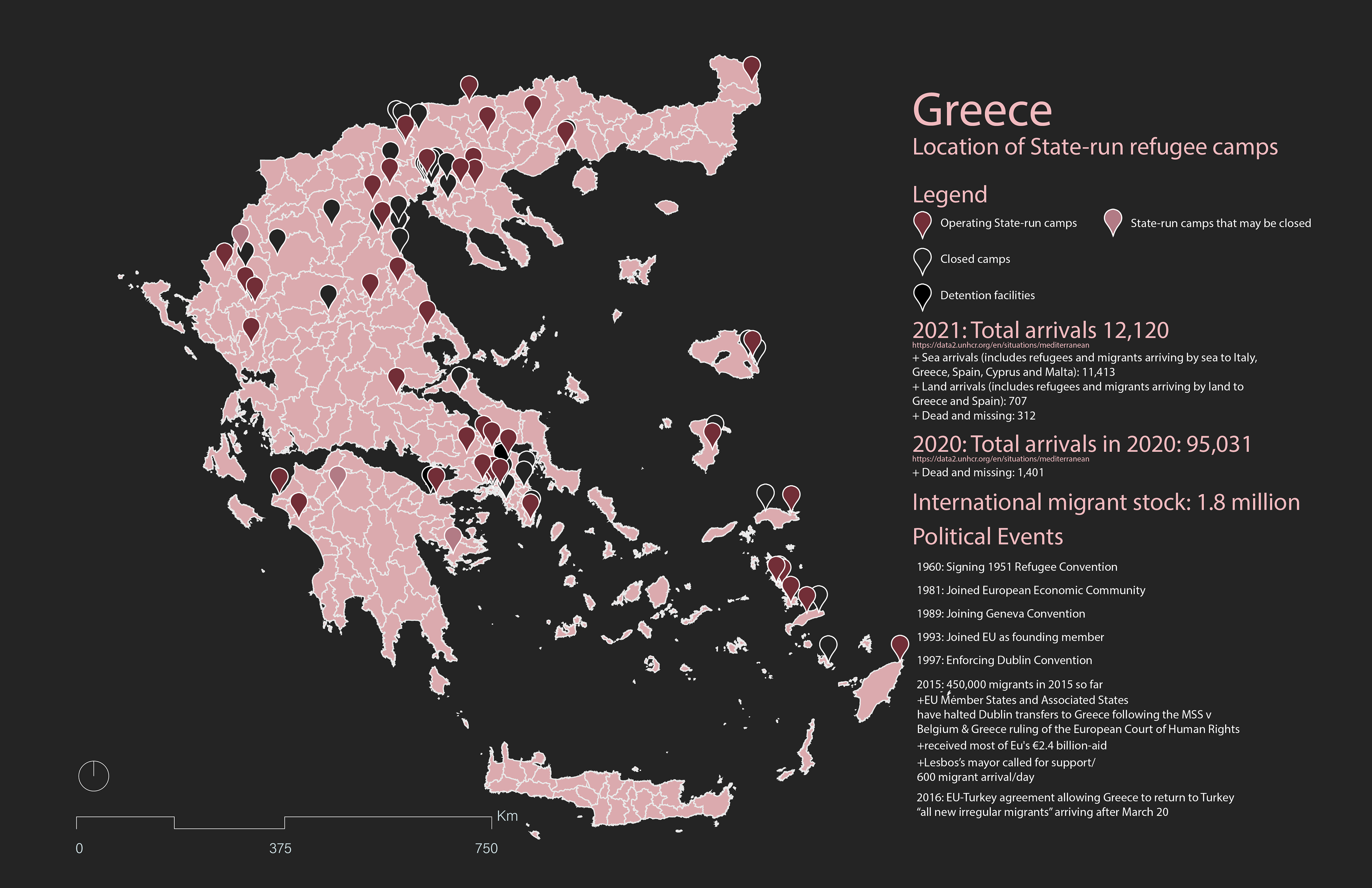
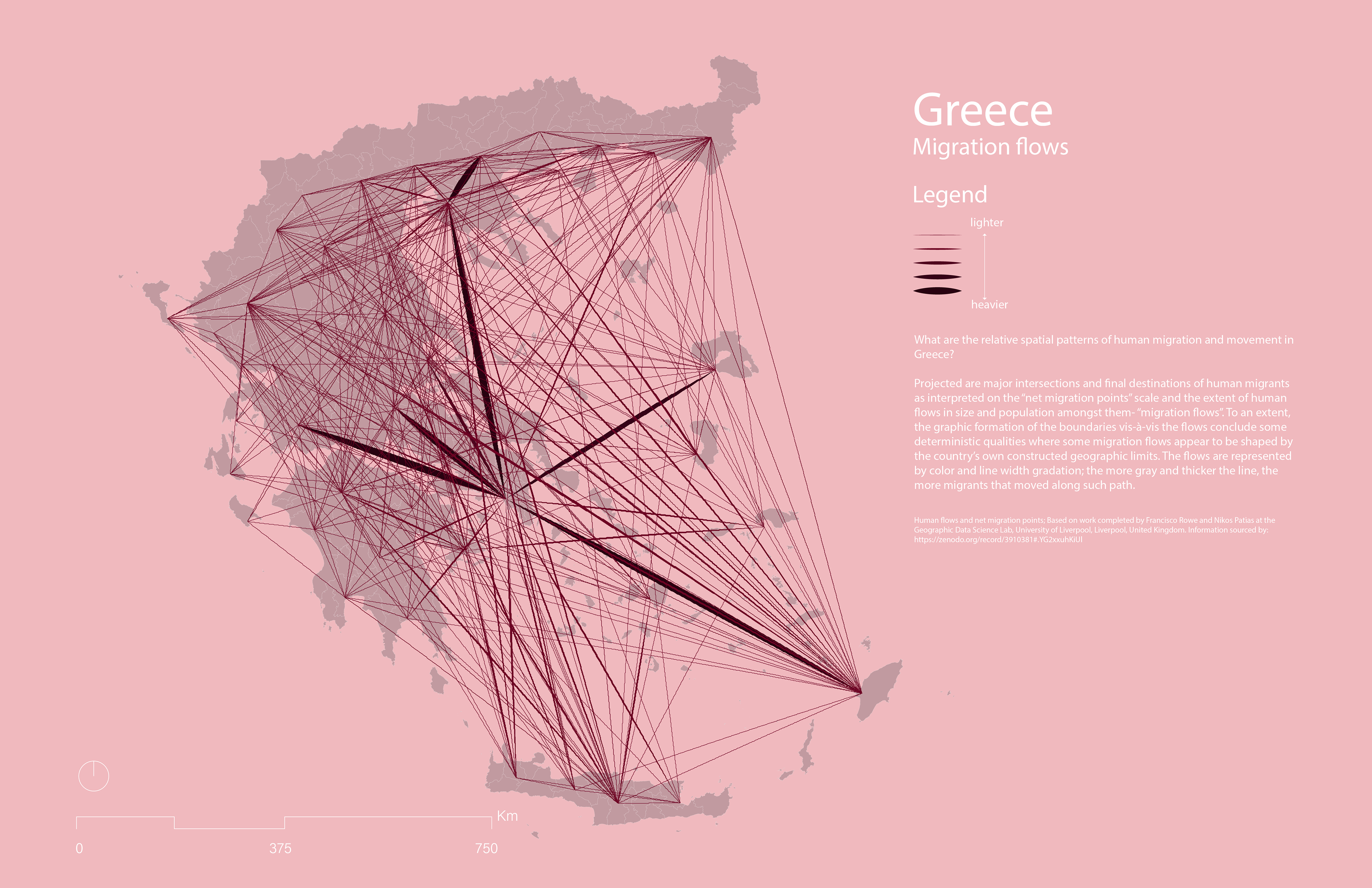
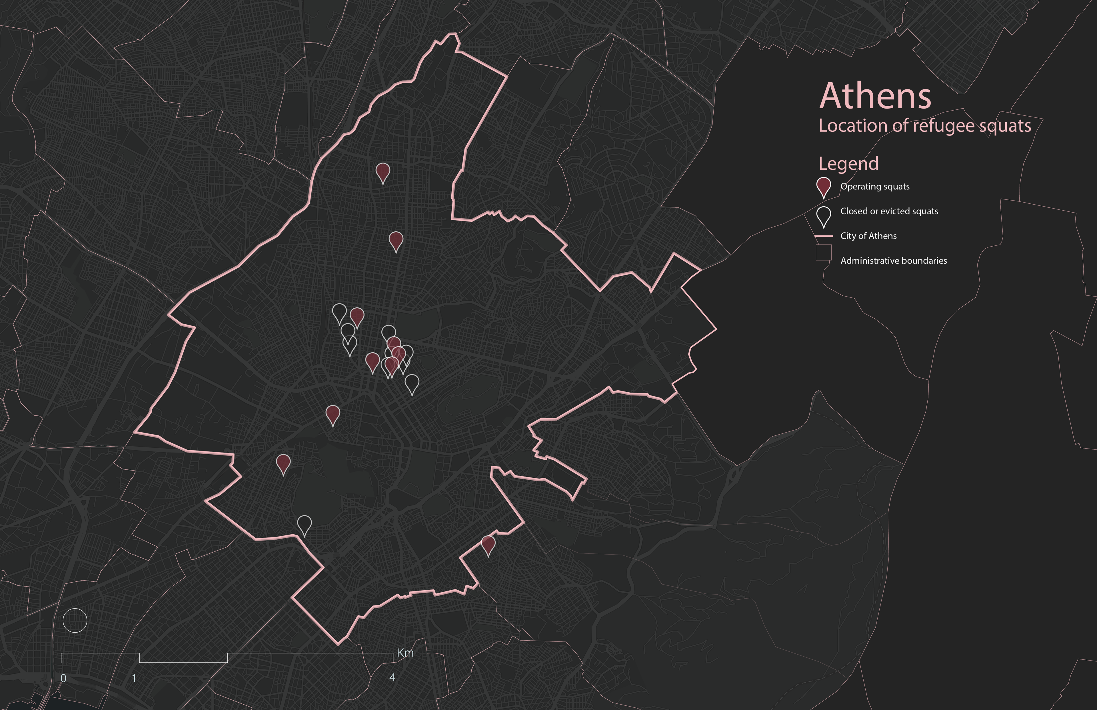
Camps and Squats: Migration challenges in the Mediterranean
In collaboration with Areti Kotsoni and Robert Nilsen, this project explores the following questions regarding human migration patterns in the Mediterranean through maps:
What are the spatial patterns of human migration and movement in the Mediterranean region?
What is the density of human migration and movement?
How can humans follow a migration path based on physical landscape characteristics, and what topographic inhibitions exist that create “borders?”

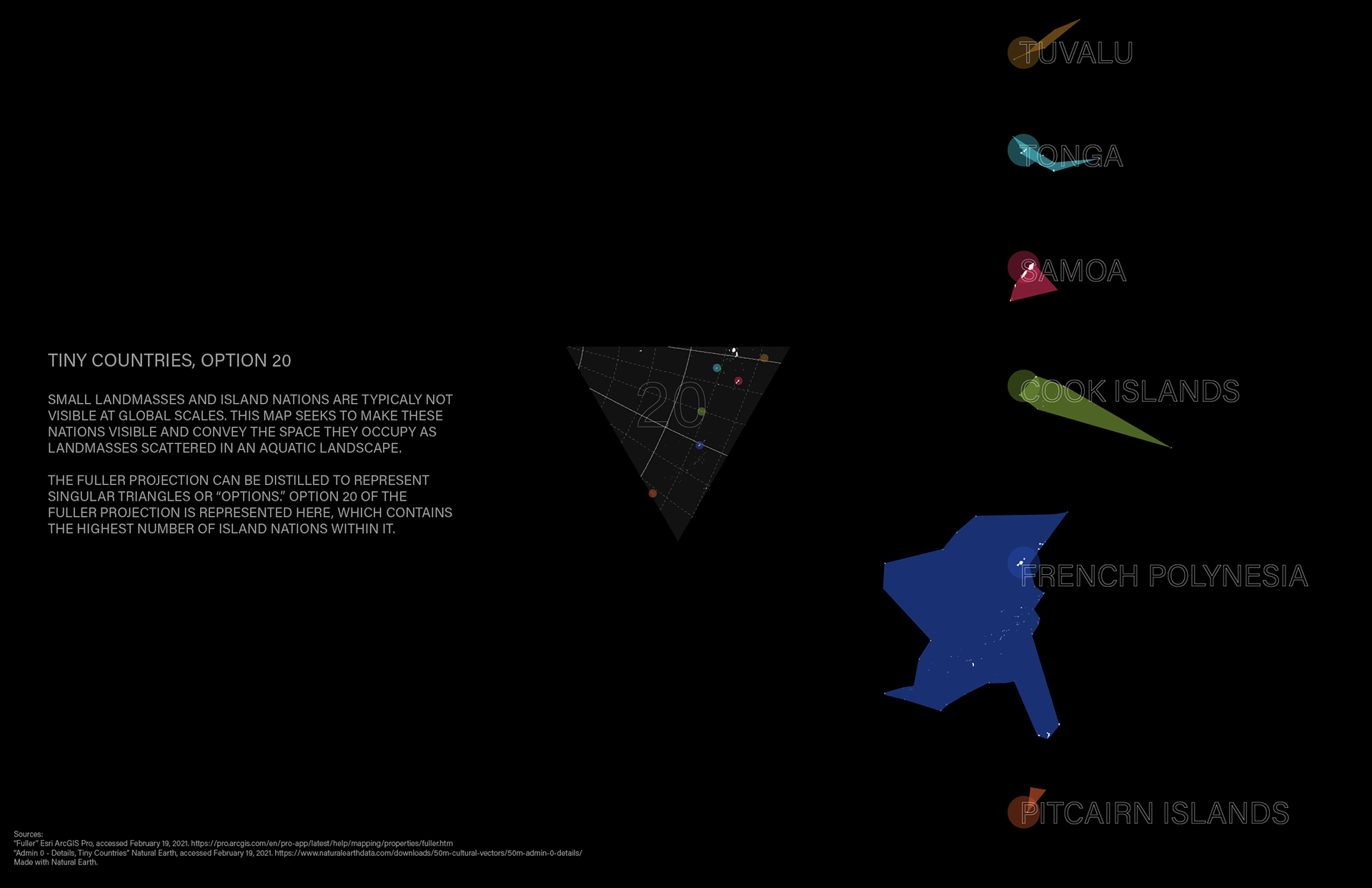
"Tiny Countries"
These maps explore how projection can influence position. Using “Tiny Countries” data from Natural Earth, these maps challenge the representation of small island nations as oversimplifications to points or dots, and seeks to make those nations visible by conveying the actual space they occupy as landmasses scattered in an aquatic landscape. Option 20 of the Fuller projection, pictured below right, contains the highest number of island nations.